New detailed online Google maps showing North Korea’s street view have been released yesterday.
Previously these appeared on Google Maps as white spaces with hardly any detail.
Google’s executive chairman recently concluded a visit to Pyongyang. North Korea’s maps are compiled with the help of the public through its Google Map Maker application.
“For a long time, one of the largest places with limited map data has been North Korea. But today we are changing that with the addition of more detailed maps of North Korea in Google Maps,” Google’s Jayanth Mysore said in a blog post.
“To build this map, a community of citizen cartographers came together in Google Map Maker to make their contributions, such as adding road names and points of interest.”
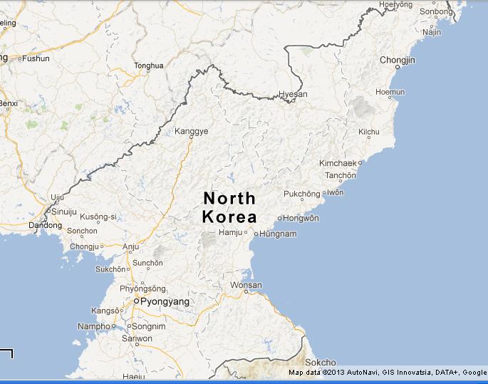
North Korea Google Maps: What does it show?
Labelled satellite photos and conventional maps and are now available for North Korea.
New google maps show Pyongyang’s subway stations and main memorials and sites. Some of North Korea’s concentration camps at Yodok in South Hamgyong Province and Bukchang north of Pyongyang are also shown on the maps. No wonder google waited their executive to leave North Korea before releasing the maps!
The Yongbyon nuclear centre and the Punggye-ri Nuclear Test Facility are also labelled.
Check out the North Korea Google Map, Street map below:
View Larger Map